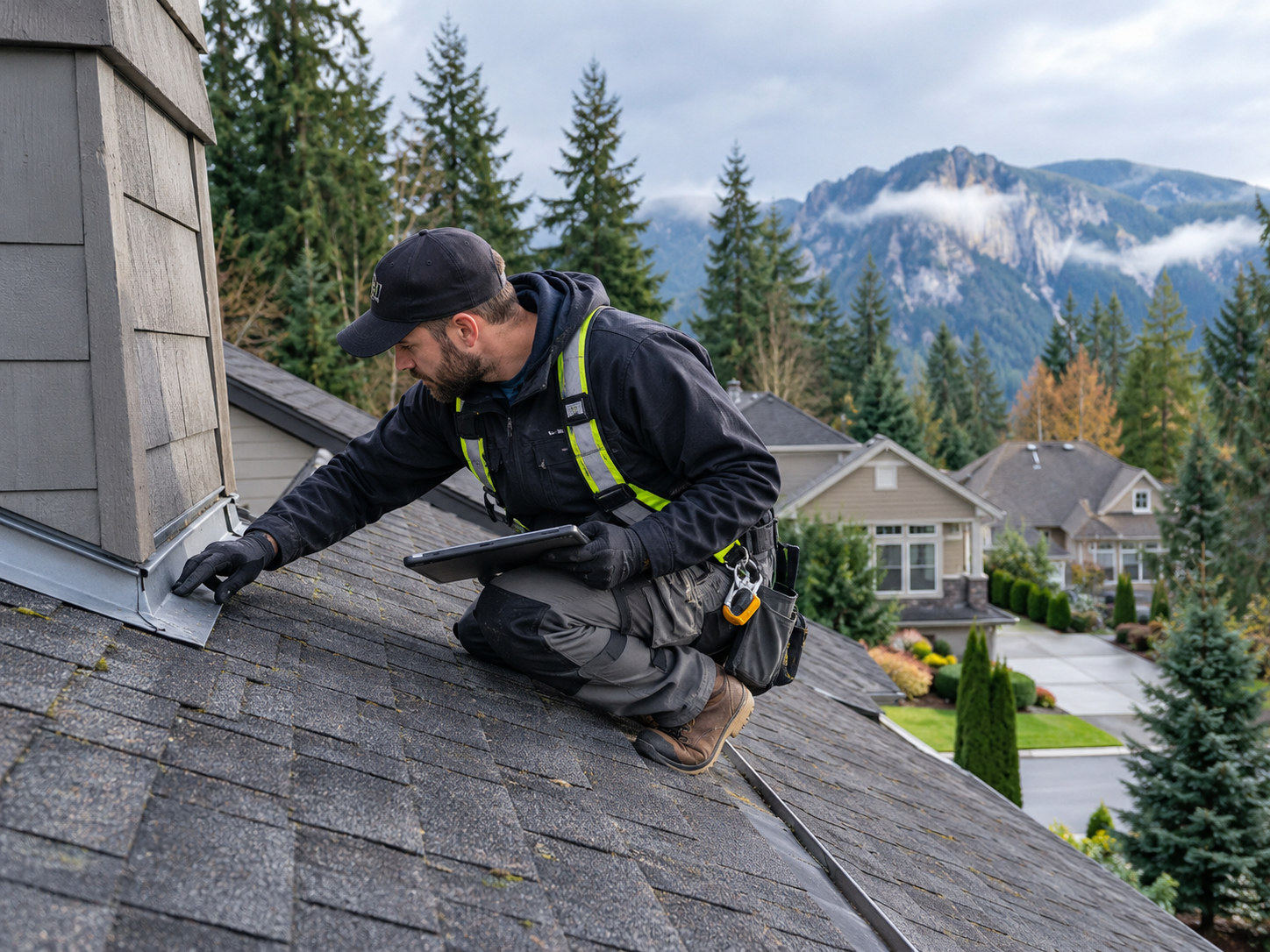
How Cascade Weather Wears on a Snoqualmie Metal Roof
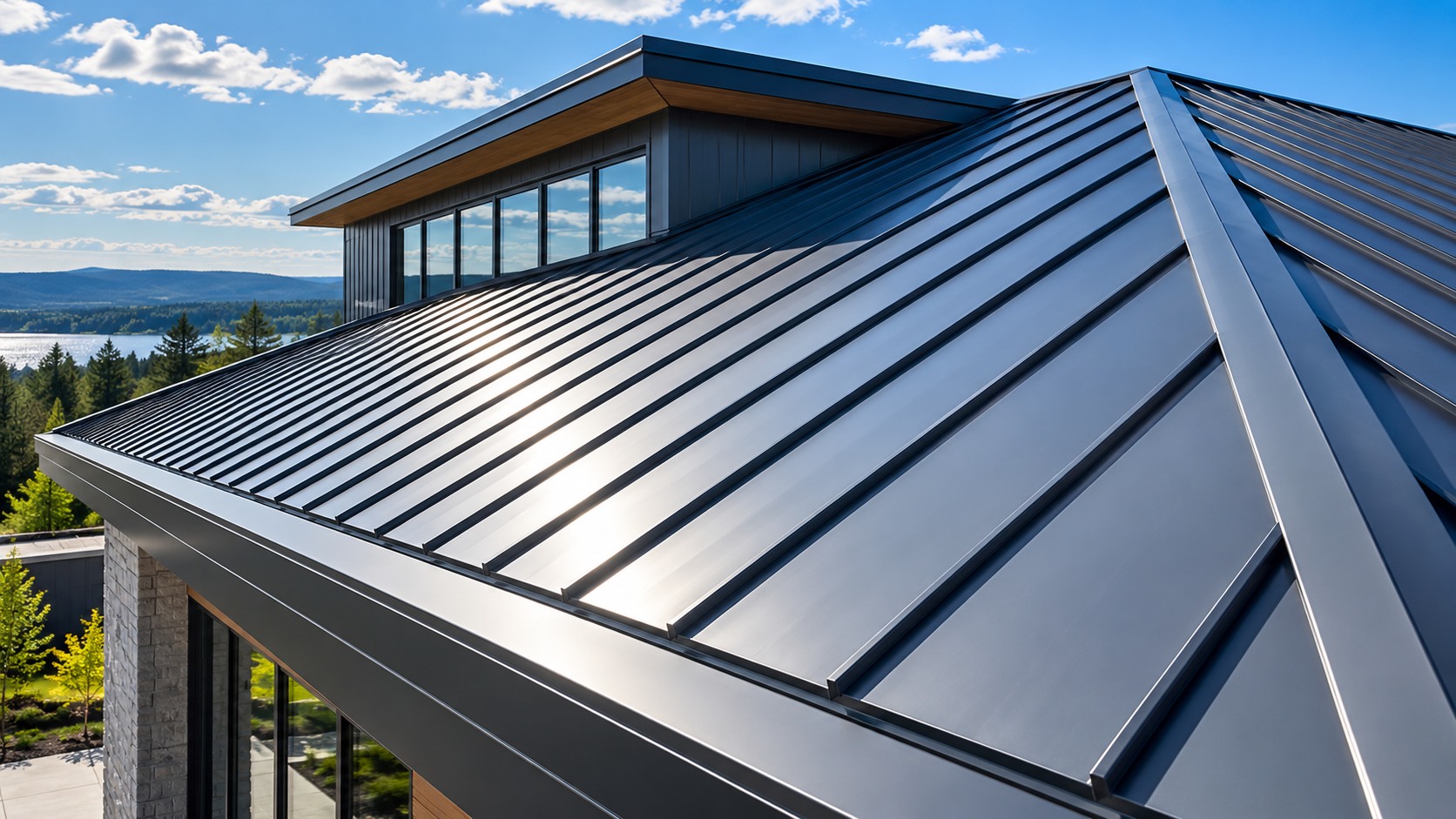
A metal roof is often chosen in Snoqualmie precisely because it stands up to Pacific Northwest weather, and it does. Metal sheds the region's constant rain, carries snow load well, and lasts far longer than many other systems. But lasting is not the same as untouched. The Cascade foothills climate works on a metal roof steadily over the years, and the wear it causes is specific and predictable. Understanding how Cascade weather ages a Snoqualmie metal roof explains why even a durable roof needs attention, and why the repairs it eventually needs concentrate at the details rather than the panels.
Constant Rain and the Long Wet Season
The defining feature of the Snoqualmie climate is water, and a lot of it. The Pacific Northwest sees well over 150 rainy days a year and more than three feet of rain, and the wet season runs long, keeping roofs damp with little time to dry between storms. For a metal roof, this constant moisture is less a threat to the panels than a steady pressure on every seam, fastener, and flashing. Water sits on these details, works into any gap that thermal movement has opened, and finds the smallest failure. A metal roof in a dry climate can go years between issues; the same roof in Snoqualmie's sustained wet faces a tougher test at every joint.
That constant damp also feeds moss. On the shaded sections of a roof under Snoqualmie's dense tree canopy, shade-loving moss takes hold and holds moisture against the metal and in the seams. Moss does not corrode metal the way it degrades shingles, but by keeping the weak points wet it accelerates the corrosion and wear that water causes. Clearing moss and keeping shaded sections clean is part of helping a metal roof reach its full life in this climate, which is why an inspection notes moss growth as more than a cosmetic issue.
Thermal Movement and the Foothills Temperature Swings
Metal moves, and that movement is the quiet force aging a metal roof's joints. Every time the temperature changes, the panels expand or contract, and in the Cascade foothills those swings are pronounced, from cold mornings to warm afternoons and across strong seasonal shifts. Over years, this repeated cycling fatigues the sealant at the seams and works the fasteners gradually loose. A screw that sealed tightly when the roof was installed can back out over many cycles, and its neoprene washer dries and loses its grip, opening a path for Snoqualmie rain to follow the fastener into the deck.
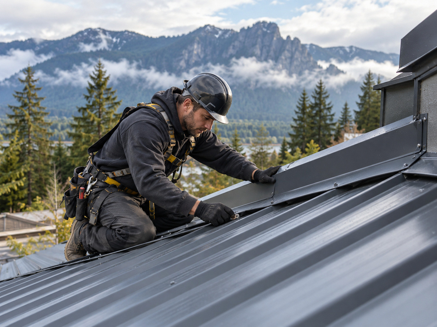
This is why so many metal roof repairs here focus on fasteners and seams. The thermal cycling is unavoidable, built into how metal behaves, and the climate's temperature range makes it more active than in a milder place. Replacing backed-out screws with oversized neo-washer fasteners and resealing fatigued seams addresses the specific damage that thermal movement causes, restoring the roof's watertightness without touching the sound panels. Catching this wear during a routine inspection, before a fastener fails completely, keeps the roof ahead of the climate rather than reacting to a leak.
Thermal Cycling Fatigues Metal Over Time
Metal roofs expand and contract with every temperature change, and over years that repeated movement fatigues sealant and works fasteners loose. In the Cascade foothills, where temperature swings are pronounced across days and seasons, thermal cycling is one of the main forces aging a metal roof's joints.
Moss Holds Moisture Against the Roof
Shade-loving moss thrives on the damp, shaded sections of Snoqualmie roofs under dense tree cover. While moss does not corrode metal directly, it traps moisture against panels, seams, and fasteners, keeping those weak points wet far longer than they would otherwise stay, which speeds their wear.
Wind Drives Rain Against Flashings
Cascade foothills wind gusts push rain sideways against the flashings and edges of a metal roof, forcing water at the exact details built to shed it. Wind-driven rain is a leading reason flashing around chimneys, skylights, and walls needs periodic attention on Snoqualmie metal roofs.
Snoqualmie's position and elevation add forces beyond the rain. Cascade foothills wind gusts drive rain sideways against flashings and roof edges, pushing water at the exact details meant to shed it and, in strong storms, working at the fasteners and edges that hold panels down. Winter brings snow load, and while metal sheds snow better than most roofs, the weight stresses the structure and the edges, and ice damming can form where snowmelt refreezes at the eaves. At Snoqualmie's elevation, freeze-thaw cycles are more pronounced than in the lowlands, and water that freezes in a seam or behind flashing expands and widens the gap, a cycle that repeats through winter.
Falling debris completes the picture. The dense tree cover around Snoqualmie drops branches and limbs that dent panels, damage flashing, and collect in valleys and gutters, where the resulting dams hold water against the roof. A branch strike can bend a panel or crack a seam directly, and debris in a valley forces water to back up and find a way under the metal. These are the storm-driven events that a metal roof in the foothills faces, and they are why a post-storm inspection is worth the visit after a significant Cascade windstorm.
Why Maintenance Beats Emergency Repair
The forces Cascade weather applies to a metal roof are gradual and predictable, which is exactly what makes them catchable. Fatigued sealant, backed-out fasteners, loosening flashing, moss on shaded sections, and debris in valleys all develop over time, and an inspection finds them before they become a leak. This is the case for maintaining a Snoqualmie metal roof rather than waiting for a stain on the ceiling: a yearly inspection, ideally before the wet season, with an extra look after a major windstorm, catches the wear while it is still a minor repair. Resealing a seam and replacing a few fasteners on a scheduled visit is far cheaper and less disruptive than the deck repair that a failed detail eventually causes.
Atlas Roofing supports that approach with free on-site inspections and a repair-first standard. The in-house, OSHA-trained crews know how Cascade weather ages a metal roof and what to look for, and the photo documentation gives an owner a clear record of the roof's condition and any wear found. Because the company is a licensed Washington contractor, license number ATLASRS758K1, bonded and insured, and works to manufacturer-approved methods, the maintenance keeps the roof within its intended performance rather than patching it with mismatched materials. For a metal roof meant to last decades in this climate, that regular attention is what lets it reach its full life.
The Life a Metal Roof Can Reach in the Foothills
A metal roof is one of the longest-lasting systems available, and even in the demanding Cascade foothills climate a well-maintained metal roof can protect a home or building for decades. The key word is maintained. The climate does not shorten a metal roof's life through any single dramatic event; it does so gradually, through the slow loosening of fasteners, the fatigue of sealant, the corrosion that moss-held moisture accelerates, and the wear that debris and wind inflict at the edges and valleys. A roof that receives regular attention stays ahead of that wear and reaches its full potential life. A roof left alone faces the same climate without defense, and small failures compound until a leak forces the issue.
This is why the economics of metal roof maintenance favor the owner so strongly. The cost of an annual inspection and the occasional reseal or fastener replacement is small against the value of the decades a metal roof can deliver, and it is far smaller than the deck and interior repairs that a neglected leak eventually requires. A metal roof is a long-term investment, and in the Cascade foothills that investment pays off best when the roof is treated as the durable-but-not-untouchable system it is, given the modest care the climate makes necessary.
What an Owner Can Watch For Between Visits
Between professional inspections, a Snoqualmie owner can watch for the signals that a metal roof needs attention sooner. Streaks of rust, particularly around fasteners or at panel edges, point to corrosion taking hold. Visible gaps or lifted sections at seams and flashings, fasteners that have clearly backed out and sit proud of the panel, and sagging or loose gutters all warrant a closer look. Inside, a new water stain, a damp patch in the attic, or daylight visible through the roof structure are clear calls to act. Heavy moss buildup on shaded sections is worth noting as well, since it holds moisture against the metal. None of these require the owner to climb the roof; they are visible from the ground, a window, or the attic.
Spotting one of these signs is the moment to call for an inspection rather than wait for the next scheduled visit. Catching a backed-out fastener or an early rust streak lets a crew address it as a minor repair, before Cascade rain drives water through the opening it has created. The owner's role is not to diagnose or fix the roof but to notice when something has changed and bring in the crew that can read it properly, which keeps the roof watertight between the regular checks that maintenance depends on.
Gutters, Debris, and the Tree Canopy
Much of the wear a Cascade metal roof takes comes not from the sky but from the trees around it. Snoqualmie's dense canopy drops leaves, needles, and branches across the roof year-round, and that debris does more damage than its weight suggests. Needles and leaves collect in valleys and against roof penetrations, holding moisture against the metal and against the flashing, and when they wash into the gutters they clog the drainage that is supposed to carry water away from the roof and the building. A clogged gutter backs water up under the roof edge and against the fascia, where it works at the very details that keep the edge watertight. Falling branches, meanwhile, dent panels and can crack a seam or displace flashing in a single strike.
Managing the canopy's effect is part of keeping a metal roof sound here. Keeping the gutters and valleys clear of accumulated debris, trimming branches that overhang the roof where practical, and checking the roof after storms that bring heavy debris all reduce the wear the trees cause. An inspection notes where debris is collecting and holding moisture, and a crew clears the valleys and drainage as part of maintaining the roof. For a Snoqualmie home set among trees, the canopy is a constant presence on the roof, and accounting for it is a real part of helping a metal roof reach its full life.
Taken together, the forces of the Cascade foothills, the constant rain, the thermal movement, the wind-driven storms, the winter cycles, the moss, and the falling debris, do not defeat a metal roof so much as test its details year after year. A roof whose seams, fasteners, flashings, and drainage are kept sound meets that test and lasts; a roof left unchecked slowly loses the contest at one detail or another. That is the whole argument for maintenance over emergency repair, and it is why a modest, regular investment of attention is what lets a Cascade metal roof deliver the decades of protection it was chosen for.
Keeping a Cascade Metal Roof Watertight
Cascade weather will keep working on a Snoqualmie metal roof year after year, but its effects are predictable and its wear is catchable, and a roof maintained with the climate in mind lasts far longer than one left to face it alone. Homeowners and building owners across Snoqualmie and King County can reach Atlas Roofing Services for a free on-site inspection and repair or maintenance matched to how the foothills climate ages a metal roof, with in-house crews and no upselling. To inspect or repair a metal roof, call (425) 475-3795 or visit atlasroofingwa.com/metal-roof-repair-snoqualmie-wa.
The second written record of the exploration of the Snoqualmie Valley comes from the notes of Samuel Hancock, who ventured up-river with the Snoqualmie tribe in 1851 in search of coal. Near the current location of Meadowbrook Bridge, Hancock was told by his guides that the land was known as Hyas Kloshe Illahee, or "good/productive land". Hancock took this useful information back with him to the area now known as Tacoma. The area that is now Snoqualmie had been continuously occupied by members of the Snoqualmie Tribe and their ancestors for at least 13,000 years.
During the 1850s, tensions were very high between the native populations and the new settlers claiming the land as their own. In 1856, in response to these tensions, Fort Alden was built near a Snoqualmie village, in the area that would become Snoqualmie. After the Treaty War ended, Fort Alden was abandoned (along with other forts built around this time).
The most successful early pioneer in the Valley was Jeremiah Borst, who arrived in the spring of 1858 over the Cedar River trail from the eastern side of the mountains. He settled in the area that formerly held Fort Alden, and used his sales of pigs and apples in Seattle to buy out much of the surrounding land from other settlers.
As successful as farming was, other settlers had different methods of working the land. The first lumber mill in the Snoqualmie Valley was established at the mouth of Tokul Creek around 1872 by Watson Allen. Within five years, there were 12 logging operations on the Snoqualmie River, providing lumber to the entire Seattle region. Within 15 years, logging and mill work was employing 140 men and sending millions of board feet of logs down the river.
In 1882, the Hop Growers Association was founded by three Puget Sound partners, who used land purchased on Snoqualmie Prairie from Jeremiah Borst to create a farm that would eventually cover 1,500 acres (6.1 km2), 900 acres (3.6 km2) of which was devoted solely to hops. This extremely successful venture (billed as "The Largest Hop Ranch in the World") would fall prey to a combination of market and pest factors, and fell into relative obscurity by the end of the 1890s.
By the late 19th century, the Puget Sound region was growing, but bypassed by the major railways. In response, a group of Seattle entrepreneurs funded and built their own railway in an attempt to cross the Cascade Range. The Seattle, Lake Shore and Eastern Railway opened up the natural resources of the Snoqualmie Valley to the markets of the world, and brought in tourists to enjoy the natural beauty of the area and to marvel at the Falls.
Our Lady of Sorrows Church in Snoqualmie
The increased interest in the area led to a marked increase in speculation. Originally, the area that would become North Bend was platted as "Snoqualmie" [8] in February 1889 by Will Taylor but later changed to "North Bend" by pressure from Seattle, Lake Shore and Eastern Railway & U.S. Post Office Department to avoid confusion. The area that is currently Snoqualmie was platted in August of that same year as "Snoqualmie Falls" by investors from Seattle. The oral history of the area places the first residents of Snoqualmie as Edmund and Louisa Kinsey, who established the first hotel, livery, general store, dance hall, post office, and meat market – in addition to helping build the first church in the town. Two of their sons (out of six children) are most famous for their photography documenting the early timber works in the region.
The Snoqualmie Falls Hydroelectric Plant, the first power plant at the Falls, was built in the late 1890s by Charles Baker, an investor from Seattle who had assisted in the platting of the city. This development provided both power and jobs to the region, and a small company town grew up near the falls to house the workers. More than 100 years later, Baker's original generators are still in use by Puget Sound Energy.
The official vote for incorporation of "Snoqualmie Falls" as the city of Snoqualmie occurred in 1903.[9] At the time, land prices had not decreased since initially set in 1889 — prices that did not reflect the financial reality of the region. In response to these high prices, people had created a large "squatting" community, building where they wanted regardless of land ownership or interests. The first challenge that the city council faced was lowering lot prices and migrating these buildings off the public right-of way, establishing the basic layout of the town that exists to this day.
In 1917, a new all-electric lumber mill (the second in the U.S.) opened across the river from Snoqualmie, along with the company town associated with it, Snoqualmie Falls. For the first half of the century, the timber industry provided the city and valley with a stable source of income and employment, even as World War I drew away workers and the Great Depression took its toll across the nation.
This prosperity was moderated during the Depression, and with the changes in culture and mobility in the latter half of the century, Snoqualmie and the majority of the valley stagnated. The city was bypassed when US-10 was built across the Cascades (now Interstate 90), and this led to a shift in commerce to the east (into North Bend) and west (into the Bellevue/Issaquah areas).
Aerial image of Snoqualmie Ridge on a snowy day (2009)
By the 1960s, the homes that had made up the company town of Snoqualmie Falls had been moved to other locations within the valley, and the city's population had stabilized to a growth rate of roughly 11 people per year over the next 30 years (from 1,216 in 1960 to 1,546 in 1990).
This slow growth cycle continued until the mid-1990s, when the city annexed 1,300 acres (5.3 km2) of undeveloped land that became the site of the current "master-planned" community of Snoqualmie Ridge, now referred to as Snoqualmie Ridge I. Snoqualmie Ridge I includes 2,250 dwelling units, a business park, a neighborhood center retail area and The Club at Snoqualmie Ridge, a private, PGA Tour-sanctioned golf course. Snoqualmie Ridge II, annexed in 2004, contains an additional 1,850 dwelling units, a hospital and a limited amount of additional retail.
The city council has continued to balance the desire to retain the rural and historical feel of Snoqualmie with the needs of a growing population. The city's historic downtown underwent a major renovation to improve its infrastructure and make the area more attractive to visitors to the valley's many natural attractions.[10] As of 2023, Snoqualmie has continued to experience growth and development, with new residential and commercial projects being completed, including the Snoqualmie Hospital in 2015, the Snoqualmie Inn, new restaurants, and more townhomes. In addition, the city has continued to provide many parks and recreation facilities, including a network of trails and public spaces such as the Snoqualmie Community Park, built in 2009.
In 2012, the city of Snoqualmie annexed 593 acres (240 ha) of the former Weyerhaeuser mill site and mill pond (Borst Lake). The former mill office now hosts Dirtfish, an advanced rally car driver training school. The site is one of the largest undeveloped industrial zoned sites in King County, although significant planning and environmental review for potential future use remains to be done. The facility hosted a round of the 2014 Global RallyCross Championship.
According to the United States Census Bureau, the city has a total area of 6.51 square miles (16.86 km2), of which 6.40 square miles (16.58 km2) are land and 0.11 square miles (0.28 km2) are water.[11]
Snoqualmie has many local parks[12] including Fisher Creek Park, Jeanne Hansen Park, Snoqualmie Community Park, Snoqualmie Point Park and Centennial Fields.
Until recently, logging and Weyerhaeuser's milling operations were the mainstays of the local economy. Since 1989, the company has run a much smaller mill operation, and ceased all operations at the Weyerhaeuser Mill Site in 2003. While dairies were a significant local industry into the early 1950s, agriculture is no longer a major economic force in the community. With the completion of Interstate 90 in the 1970s, Snoqualmie became more accessible to Seattle and the Eastside region, resulting in more residents working in the communities to the west.
The Snoqualmie Ridge Business Park was developed in the 1990s on 180 acres (73 ha) of land that was divided into parcels for over a dozen facilities. It employs over a thousand people, of which a majority live within the city. The business park's major employers include Space Labs,[citation needed] Motion Water Sports, Technical Glass, T-Mobile, Zetec, and the King County Department of Permitting and Environmental Review.[15]Philips Oral Healthcare has hundreds of employees in Snoqualmie that manufacture the Sonicare electric toothbrush.[16]
The city is also home to a tourism industry that developed due to the scenic and recreational attractions in the area. The Snoqualmie Falls and adjacent Salish Lodge are a major attraction adjacent to Puget Sound Energy's Snoqualmie Fall Park that draw 1.5 million annual visitors.[17] The Northwest Railway Museum in downtown Snoqualmie owns a historic depot and operates heritage railway rides.[18] The Snoqualmie Indian Tribe owns the Snoqualmie Casino, which opened in 2008 a few miles outside city center.[19]
As of the 2020 census, Snoqualmie had a population of 14,121 and a median age of 36.0 years. 34.0% of residents were under the age of 18 and 6.3% of residents were 65 years of age or older. For every 100 females there were 97.2 males, and for every 100 females age 18 and over there were 92.8 males age 18 and over.[23]
98.9% of residents lived in urban areas, while 1.1% lived in rural areas.[24]
There were 4,552 households in Snoqualmie, of which 56.9% had children under the age of 18 living in them. Of all households, 71.5% were married-couple households, 8.2% were households with a male householder and no spouse or partner present, and 15.7% were households with a female householder and no spouse or partner present. About 11.1% of all households were made up of individuals and 3.4% had someone living alone who was 65 years of age or older.[23]
There were 4,674 housing units, of which 2.6% were vacant. The homeowner vacancy rate was 0.3% and the rental vacancy rate was 4.0%.[23]
In April 2013, the city of Snoqualmie retained the Economic Development Council of Seattle and King County (EDC) to conduct research and make recommendations that would guide and support a marketing effort aimed at increasing occupancy in the Snoqualmie Ridge Business Park. The city was also interested in recommendations for the use of the Snoqualmie Mill site, and in an estimate of the potential for additional land absorption at Snoqualmie Ridge. EDC issued its final report in September 2013,[26] with updated demographic information about Snoqualmie. The highlights are summarized here.
The average household income in this area is estimated to be $135,386 for the current year (2013), while the average household income is estimated to be $90,874 for King County, $108,160 for Bellevue, $111,460 for Issaquah, $74,847 for Washington, and $70,968 for the United States, for the same time frame. The average household income in this area is projected to increase 5.6% over the next five years, from $135,386 to $142,906. The United States is projected to have a 4.8% increase in average household income.
Education levels are also high. Currently, it is estimated that 9.0% of the population age 25 and over in this area had earned a Master's, Professional, or Doctorate Degree and 24.3% had earned a bachelor's degree. In comparison, for the United States, it is estimated that for the population over age 25, 8.9% had earned a Master's, Professional, or Doctorate Degree, while 15.5% had earned a bachelor's degree.
The age distribution of the population shows that approximately 35% of the residents are children (age 0–19), 51% are age 20–54, and 14% are 55 and older. Thus the community is primarily a home for working families. Average household size is approximately 3.07; a "typical" household is two adults and one child. The current year median age for this population is 34.2, while the average age is 31.2. Five years from now, the median age is projected to be 35.1. The current year median age for the United States is 36.5, while the average age is 37.7. Five years from now, the median age is projected to be 37.2.
Snoqualmie Falls is featured notably in Twin Peaks.
As of the 2010 census,[27] there were 10,670 people, 3,547 households, and 2,912 families residing in the city. The population density was 1,667.2 inhabitants per square mile (643.7/km2). There were 3,761 housing units at an average density of 587.7 per square mile (226.9/km2). The racial makeup of the city was 83.3% White, 0.8% African American, 0.9% Native American, 9.3% Asian, 0.1% Pacific Islander, 1.4% from other races, and 4.4% from two or more races. Hispanic or Latino of any race were 5.3% of the population.
There were 3,547 households, of which 55.4% had children under the age of 18 living with them, 71.3% were married couples living together, 7.7% had a female householder with no husband present, 3.1% had a male householder with no wife present, and 17.9% were non-families. 13.1% of all households were made up of individuals, and 1.7% had someone living alone who was 65 years of age or older. The average household size was 3.01 and the average family size was 3.33.
The median age in the city was 33.7 years. 35% of residents were under the age of 18; 3.1% were between the ages of 18 and 24; 38.9% were from 25 to 44; 19.2% were from 45 to 64; and 3.9% were 65 years of age or older. The gender makeup of the city was 50.0% male and 50.0% female.
Many of the exterior shots for David Lynch and Mark Frost's Twin Peaks television series and movie (Fire Walk with Me) were filmed in Snoqualmie and in the neighboring towns of North Bend and Fall City. The municipal government of Snoqualmie and some local businesses have embraced the town's association with the show, which continues to be a significant driver of tourism in the area.[32] The Snoqualmie chamber of commerce collaborated in organizing the first Twin Peaks Fan Festival in 1992 from August 14–16, anticipating the release of Fire Walk With Me, which premiered early at the North Bend Theatre with a live introduction by Lynch himself.[33] Subsequently, a smaller fan-organized festival was held from 1993 to 2019.[34] Since 2023, an officially proclaimed[35] "Real Twin Peaks Day" has been celebrated on the 24th of February, and in 2024, star Kyle MacLachlan attended the festivities.[32][36] Several attempts have been made to permanently install a "Welcome To Twin Peaks" sign on Snoqualmie's Reinig Road, but they are usually stolen or vandalized shortly after being placed.[37][38][39]
Actress Ella Raines was born on August 6, 1920, in Snoqualmie Falls, a mill town across the Snoqualmie River that is now part of Snoqualmie.
After a long history as an important salmon fishing area for Native Americans, Renton was first settled by people of European descent in the 1860s. Its early economy was based on coal mining, clay production, and timber export. Today, Renton is best known as the final assembly point for the Boeing 737 family of commercial airplanes, but it is also home to a growing number of well-known manufacturing, technology, and healthcare organizations, including Boeing Commercial Airplanes Division, Paccar, Kaiser Permanente, Providence Health & Services, UW Medicine, and Wizards of the Coast.
Aerial view of the south end of Lake Washington with a view of Renton Boeing plant at the tip
Long a cultural center for the Duwamish, European settlers arrived in the area of present-day Renton as early as 1853. First among them were Henry Tobin and his wife Diana. The town of Renton was accessed via the Seattle and Walla Walla Railroad, the first railroad to be built to Seattle, and was in the vicinity of several coal mines that attracted entrepreneurs like Erasmus M. Smithers, who is credited with the founding and establishment of the town in 1875.[7] Smithers named Renton in honor of Captain William Renton, a local lumber and shipping merchant who invested heavily in the coal trade.[8] Smithers discovered coal there and brought in Charles D. Shattuck as the coal mine operator.
Renton was incorporated as a city on September 6, 1901,[7] when coal mining and timber processing were the most important economic industries in the area. The town was prone to flooding from the Cedar River and Black River. In 1916 the completion of the Lake Washington Ship Canal lowered the surface of Lake Washington by several feet which consequently eliminated drainage of Lake Washington through the Black River (in favor of the Ship Canal). The Cedar River was then diverted to drain into Lake Washington instead of into the Black River. As a result, the Black River largely disappeared, leaving only a few remnants.[9] The culmination of these actions reduced the threat of annual flooding.[10]
The game company Wizards of the Coast also is headquartered in Renton. Providence Health System has centralized its administrative offices in Renton, along with Group Health Cooperative.
Owing to its location at the confluence of three major freeways (I-5, I-405, and SR 167), Renton's economic development team has lured a number of specialty retailers that draw consumers from around the region, including IKEA.[12] Some retail establishments were unwanted though, and the city successfully defended zoning restrictions on pornographic theaters before the U.S. Supreme Court in Renton v. Playtime Theatres, Inc.[13]
The Renton Public Library was built directly over the Cedar River and opened in 1966. It stretches 80 feet (24 m) across the river, next to Liberty Park, and was the main branch of the city's independent library system until its 2010 annexation into the King County Library system.
Renton skyline along Lake Washington, featuring the Southport development
The city government has encouraged redevelopment of industrial areas around Downtown Renton and near Southcenter since the 1980s. The first IKEA in the Pacific Northwest opened in Renton in 1994 at a former Boeing building;[14] the original building was replaced by a new store on the same site in 2017.[15] The former Longacres horse-racing track was redeveloped in the 1990s to support offices for Boeing and the Federal Reserve Bank, which moved from its Seattle building.[16] Port Quendall, a land parcel in north Renton, is home to the Virginia Mason Athletic Center (VMAC), housing the Seattle Seahawks Headquarters and training facility that opened in August 2008; before then, the Seahawks trained in Kirkland.[17]
In the mid-1990s, Renton undertook a major redevelopment effort to revitalize its downtown core, which had declined in commercial prominence since the opening of the Southcenter Mall in Tukwila in 1968. The many car dealerships that had previously occupied the center of downtown Renton were encouraged through economic incentives to relocate to a newly created auto sales zone close to the I-405/SR-167 interchange.[18] In place of the old dealerships downtown, a new transit center and parking garage were built in partnership with King County Metro.[19] The transit center is surrounded by several multi-family residential buildings and a small town square named Piazza Park, which hosts a weekly farmers' market.[20]
Renton Transit Center
Centered on former Boeing Co. property near the south shore of Lake Washington is a 68-acre (280,000 m2) residential and commercial development named The Landing.[21] To the north of the Landing, a hotel and office development on the lakefront called Southport has been developed at the site of the former Shuffleton power plant, which was demolished in 2001. A 347-room hotel operated under the Hyatt Regency brand opened in June 2017.[22]
In 2017, Bosa Development announced plans to build five residential towers between 16 and 23 stories at Quendall Terminals, a Superfund site in Renton on the shore of Lake Washington. The proposal was never formally approved by the city government, which had permitted six-story buildings on the site, and was dropped in 2024.[23]
Seattle Car and Foundry works (Paccar) plant in Renton 1916
Renton is located on the southeast shore of Lake Washington at the mouth of the Cedar River.[24] The city is bordered to the north by Newcastle. Along the east side of Renton is the urban growth boundary established by King County,[25] as such there is no incorporated city directly east of Renton. The southern border is shared with Kent, while the western border consists of the city of Tukwila and the unincorporated community of West Hill.[26]
The geographical characteristics of Renton's eastern border are varied and include (from north to south) the south flank of Cougar Mountain descending southward merging with the community of May Valley. The terrain then elevates south of May Valley to the communities of the East Renton Plateau before descending to the north bank of the Cedar River.
According to the United States Census Bureau, the city has a total area of 25.27 square miles (65.45 km2), of which 23.54 square miles (60.97 km2) is land and 1.73 square miles (4.48 km2) is water,[3] most of which is the Cedar River.
Potential Annexation Areas (PAAs) include the communities of Fairwood southeast of Renton, the East Renton Plateau on the eastern edge of Renton, and West Hill northwest of Renton. These communities are large unincorporated urban areas that are encouraged by the King County Annexation Initiative[27] to incorporate as cities or annex into neighboring cities. As of 2012 these three PAAs are not part of the City of Renton, and not included in its demographics or statistics.
Renton is one of the cities in the Puget Sound region with an independent street grid system. Roads names beginning with sectional divisions (N 32nd Street) generally follow a latitudinal direction, while roads names ending in a sectional direction (Duvall Ave NE) generally follow a longitudinal direction. Many of the avenues in the city are named in honor of other cities in Washington.
Renton has a warm-summer Mediterranean climate (Köppen: Csb) with warm and dry summers mixed with cloudy, wet and cool winters, with a precipitation regime typical of the Pacific Northwest. Being located in a partial rain shadow and shielded from the coastal summers, Renton has more of a climate influenced by the interior than many other areas nearby.[citation needed]
As of the 2023 American Community Survey, there are 40,968 estimated households in Renton with an average of 2.53 persons per household. The city has a median household income of $100,237. Approximately 7.9% of the city's population lives at or below the poverty line. Renton has an estimated 71.7% employment rate, with 38.4% of the population holding a bachelor's degree or higher and 86.2% holding a high school diploma.[31]
The top five reported ancestries (people were allowed to report up to two ancestries, thus the figures will generally add to more than 100%) were English (59.2%), Spanish (12.8%), Indo-European (7.0%), Asian and Pacific Islander (16.4%), and Other (4.6%).
Renton, Washington – racial and ethnic composition Note: the US Census treats Hispanic/Latino as an ethnic category. This table excludes Latinos from the racial categories and assigns them to a separate category. Hispanics/Latinos may be of any race.
As of the 2020 census, Renton had a population of 106,785, with 41,433 households and 25,537 families; the median age was 36.9 years. 21.0% of residents were under the age of 18, 6.5% were under the age of 5, and 12.8% were 65 years of age or older. For every 100 females there were 99.0 males, and for every 100 females age 18 and over there were 97.4 males age 18 and over.[35]
The population density was 4,549.1 inhabitants per square mile (1,756.4/km2). There were 43,362 housing units at an average density of 1,847.2 inhabitants per square mile (713.2/km2), of which 4.4% were vacant; the homeowner vacancy rate was 1.0% and the rental vacancy rate was 5.2%.[35]
100.0% of residents lived in urban areas, while 0.0% lived in rural areas.[36]
As of the 2010 census, there were 90,927 people, 36,009 households, and 21,849 families residing in the city. The population density was 3,932.8 inhabitants per square mile (1,518.5/km2). There were 38,930 housing units at an average density of 1,683.8 inhabitants per square mile (650.1/km2). The racial makeup of the city was 54.64% White, 10.63% African American, 0.66% Native American, 21.22% Asian, 0.75% Pacific Islander, 6.24% from some other races and 5.85% from two or more races. Hispanic or Latino people of any race were 13.14% of the population.
There were 36,009 households, of which 32.4% had children under the age of 18 living with them, 43.2% were married couples living together, 11.9% had a female householder with no husband present, 5.5% had a male householder with no wife present, and 39.3% were non-families. 30.3% of all households were made up of individuals, and 7.9% had someone living alone who was 65 years of age or older. The average household size was 2.51 and the average family size was 3.16.
The median age in the city was 35.2 years. 23.2% of residents were under the age of 18; 8.8% were between the ages of 18 and 24; 33.5% were from 25 to 44; 24.4% were from 45 to 64; and 10.1% were 65 years of age or older. The gender makeup of the city was 49.5% male and 50.5% female.
The Boeing Renton Factory has operated since World War II, when it manufactured the B-29 Superfortress; currently, it produces the 737 airliner. The Renton plant produced the Jetfoil and Pegasus class hydrofoils in the 1970s. As of 2001, 40% of all commercial aircraft in the air were assembled in Renton. Boeing remains the largest employer in Renton, which is home to over 10,000 employees and three of the aerospace giant's six major business divisions: Boeing Commercial Airplanes, Boeing Capital Corporation and the Shared Services Group. The local newspaper in the 1970s, the Record-Chronicle, proclaimed the city the jet capital of the world.
Paccar has traditionally been a large employer in the city as well with its Kenworth Truck plant located in Renton's industrial area on the south end of Lake Washington. In 1907 the Seattle Car Manufacturing Co. moved to a large manufacturing plant in Renton after a fire destroyed the original plant in Seattle. The Car Company was the only manufacturer of train cars on the West Coast.
The Renton plant expanded its foundry capabilities in 1911, and Seattle Car and Foundry Co merged with the Twohy Brothers of Portland in 1917 and became the Pacific Car and Foundry Company or Paccar. During the Great Depression, the Renton Paccar plant developed power winches for use in the logging industry. When World War II arrived, the Renton manufacturing switched its production towards the war effort, and by the war's end in 1945 had built 1,500 Sherman Tanks. In the second half of the 20th century there was not enough repeat business for Paccar-built train cars as rail equipment in 1965 came to only 1/3 of the company's sales. Thus the Paccar Renton plant began manufacturing structural steel until the 1970s recession. In the early 1980s the Paccar Railcar Division, the last remnants of the original Pacific Car and Foundry Co., closed down. In 1993, a new Kenworth assembly plant opened on the former site of Pacific Car and Foundry.[42]
The Renton School District includes the four high schools: Hazen High School, Lindbergh High School, Renton High School, and Albert Talley Senior High School. The school district also has four middle schools and fifteen elementary schools.
Renton has a mayor–council government that oversees municipal services and contracts with other entities for utilities. The mayor and seven councilmembers are elected to four-year terms in staggered, at-large elections.[49][50] Councilmembers are divided into working committees that recommend legislation to the whole council in meetings.[51] Renton also has a housing authority to provide low cost housing to poorer residents.[52]
The city government owns and operates Renton Municipal Airport (KRNT), officially Clayton Scott Field, a public airport at the foot of Lake Washington. It is used by the Boeing Renton Factory as well as for charter services and flight training.[58]
The BNSF Railway operates a freight railroad through Renton that includes a brief street-running portion on Houser Way in downtown.[59][60] The railroad carries Boeing 737 fuselages bound for the Boeing assembly plant north of downtown.[61] A second line with street-running portions, along Burnett Avenue to serve the Paccar plant, was removed in 1972 to eliminate 18 grade crossings.[62][63] BNSF also owned the Woodinville Subdivision, a branch line on the east side of Lake Washington, which was used by the Spirit of Washington dinner train. The excursion service ran from Renton to Woodinville from 1992 to 2007.[64] The Woodinville Subdivision was converted to a multi-use trail, known as Eastrail, by the King County government in 2018.[65]
^Williams, David B.; Ott, Jennifer (2017). Waterway: The Story of Seattle's Locks and Ship Canal (First ed.). Seattle: HistoryLink.org. pp. 121–123. ISBN978-1-933245-43-0.
Because water sits on a low-slope roof and tests every joint. Heat-welding TPO or PVC membrane sheets creates a continuous watertight bond rather than relying on adhesives that can fail, which is a real advantage in a climate where the roof stays wet. Atlas Roofing installs these welded single-ply systems across Seattle and King County.
How does snow affect a metal roof in the Cascade foothills?
Correctly welded seams, properly detailed flashing at parapets and penetrations, drainage designed so water leaves the roof, and a membrane of the right thickness. Poor installation of any of these causes early leaks. Atlas Roofing installs to manufacturer specifications with in-house OSHA-trained crews so the roof reaches its full service life.
How often should a Snoqualmie metal roof be inspected?
A yearly inspection suits most Snoqualmie metal roofs, ideally before the wet season, with an extra look after any major windstorm. The Cascade climate works seams, fasteners, and flashings loose over time, and catching that wear early keeps a roof watertight. Atlas offers free on-site inspections for exactly this purpose.